Evacuate
Evacuation routes are predetermined so you can become familiar with the ones nearest you. Traffic along certain sections of major evacuation routes may be adjusted to flow in one direction away from the coast. State and local law enforcement will be at traffic control points along these evacuation routes to guide you to safety.
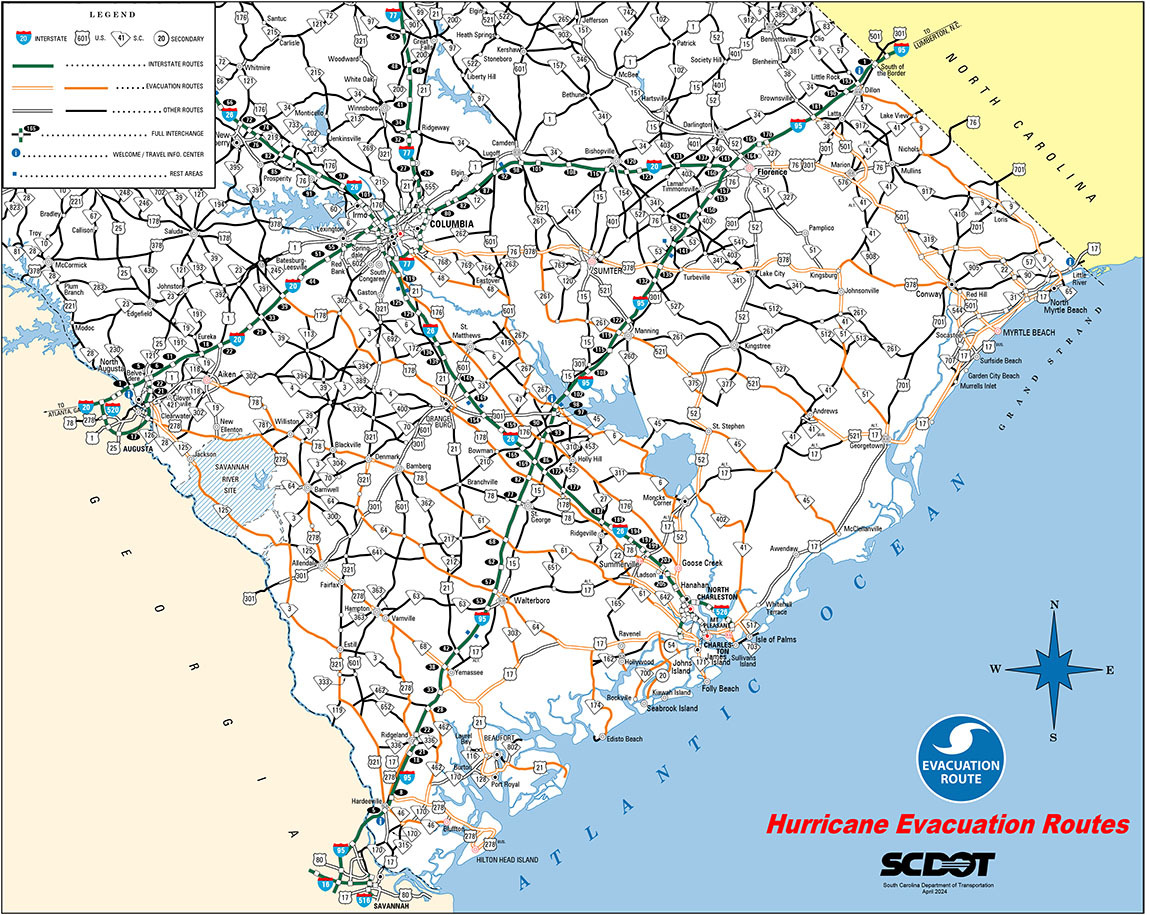
Grand Strand Area
Myrtle Beach
- 10th Avenue North and northward to Briarcliff Acres use SC 22 (Conway Bypass) to US 501. Motorists using SC 31 (Carolina Bays Parkway) or the Grissom Parkway will be directed north to SC 22.
- South of 10th Avenue North southward to the Myrtle Beach Airport use US 501 toward Marion and beyond.
- Under certain conditions, US 501 will be converted to four lanes northbound from SC 22 to SC 576.
- Myrtle Beach Airport southward through Surfside Beach use SC 544 to US 501.
- Under certain conditions, US 501 will be converted to four lanes northbound from SC 544 to US 378. The reversed lanes will carry SC 544 traffic onto US 378 where it will travel westbound to I-95 or Columbia.
NORTH MYRTLE BEACH & NORTHWARD
- Use SC 9 to proceed to I-95.
GARDEN CITY BEACH SOUTH TO WINYAH BAY, GEORGETOWN
- Take US 17 south through Georgetown, then take US 521 to SC 261 to US 378 to Columbia.
- Under certain conditions, an alternate route from Georgetown will be Black River Road to US 701 to SC 51 to SC 41 to US 378 at Kingsburg.
Hilton Head & Beaufort Areas
Hilton Head Island
- Hilton Head Island evacuees will use both the William Hilton Parkway (US 278 Business) and the Cross Island Parkway toll facility (US 278).
- As these two roads merge, a third lane will be formed by reversing flow on the inside eastbound lane of US 278. This lane will carry traffic from the toll facility to the three lane section beginning on the mainland.
- LANE ASSIGNMENTS WILL BE AS FOLLOWS:
- The right lane on US 278 westbound will exit onto SC 170, proceed to SC 462, then be directed to I-95 northbound at I-95 exit 28.
- The center lane on US 278 westbound will become the right lane at SC 170 which will be directed to I-95 northbound at exit 8.
- The left lane on US 278 westbound at SC 170 will continue on US 278 to Hampton and eventually to North Augusta.
Beaufort
-
Two-Lane Evactuation:
Evacuees will use the two present northbound lanes on US 21 to US 17. Upon reaching US 17, the right lane will be directed to US 17 north to SC 303 to Walterboro. The left lane will be directed to US 17 south, then to US 17 Alt / US 21 to Yemassee and then ultimately to North Augusta. -
Three-Lane Evacuation:
Under certain conditions, a third northbound lane will be formed by reversing flow in the inside southbound lane of US 21 at US 21 Business west of Beaufort, accommodating traffic from US 21. This reversed lane will be directed to US 17 southbound and eventually I-95 northbound at exit 33 (Point South). The remaining two lanes will be used as described above for the two-lane evacuation.
Charleston Area
Edisto Island, Adams Run
- Evacuees will take SC 174 to US 17. They will then take US 17 south to SC 64. This will take them to Walterboro, and then to Aiken and I-20
Yonges Island, Meggett, Hollywood, Ravenel
- Use SC 165 to US 17, then US 17 south to SC 64 where they will go to Walterboro, then to Aiken and I-20.
Johns Island, Kiawah Island & Seabrook
- Use SC 700 to Main Road (S-20) to US 17.
- Evacuees will then take US 17 south to SC 64 where they will go to Walterboro, then to Aiken and I-20.
James Island & Folly Beach
- Use SC 171 to US 17.
- Evacuees should then travel south on US 17 to I-526 to the normal lanes of I-26.
- Under certain conditions, access to the reversed lanes of I-26 will begin at the Nexton Crossover near Exit 197. Please follow evacuation instructions provided by law enforcement, official traffic control devices, and SCDOT 511.
Awendaw & McClelanville
- Evacuees will take SC 45 to US 52 where they will be directed right onto US 52 to SC 375 to US 521 to SC 261 to US 378 to Columbia.
City of Charleston
- The west side of the city (West Ashley) will use SC 61 to US 78, US 321, and SC 389 to I-20.
- Downtown will use the normal lanes of I-26.
- Under certain conditions, access to the reversed lanes of I-26 will begin at the Nexton Crossover near Exit 197. Please follow evacuation instructions provided by law enforcement, official traffic control devices, and SCDOT 511.
North Charleston
- Evacuees will take US 52 (Rivers Avenue) to US 78 to US 178 to Orangeburg then to I-20 or continue on US 52 to US 176 or continue north on US 52.
- The right lanes of US 52 at Goose Creek will continue on to Moncks Corner. In Moncks Corner, evacuees will be directed onto SC 6, where SC 6 will take them toward Columbia.
- The left lanes of US 52 at Goose Creek will go onto US 176 to Columbia.
- Evacuees using SC 642 will travel west toward Summerville and take road S-22 (Old Orangeburg Road) to US 78 west.
East Cooper
- Evacuees leaving Mount Pleasant will take I-526 or US 17 south to I-26.
- Those leaving Sullivan's Island will use SC 703 to I-526 Business to access I-526, then I-26.
- Evacuees from the Isle of Palms will use the Isle of Palms connector (SC 517) to go to US 17, where the right lane will turn north on US 17, then proceed to SC 41, to SC 402, then to US 52 to SC 375, then to US 521, to SC 261 to US 378 to Columbia.
- Evacuees using the left lanes of the Isle of Palms connector will turn left to go to I-526 and then on to I-26.
- Evacuees on I-526 from East Cooper will be directed to the normal westbound lanes of I-26.
- Under certain conditions, access to the reversed lanes of I-26 will begin at the Nexton Crossover near Exit 197. Please follow evacuation instructions provided by law enforcement, official traffic control devices, and SCDOT 511.
Daniel Island
- Use I-526 or Clements Ferry Road as conditions warrant.
Evacuation Actions
Be Prepared
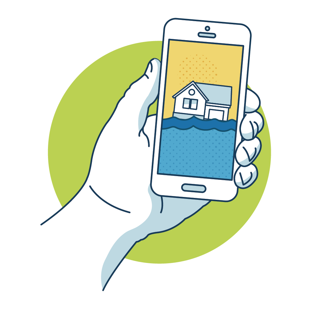
Contact your local emergency management office to assist in determining your vulnerability to a hurricane. A storm surge may extend beyond coastal areas, but hurricanes also bring high winds, tornadoes, heavy rains, and flooding to inland areas.
If you live in a vulnerable area, be sure to plan an evacuation route. Consider staying in a hotel or with family and friends outside of the vulnerable area. Learn safe routes inland. Be ready to drive at least 20 to 50 miles inland to locate a safe place.

Know where you will go
Make arrangements for pets
Fuel up and service vehicles
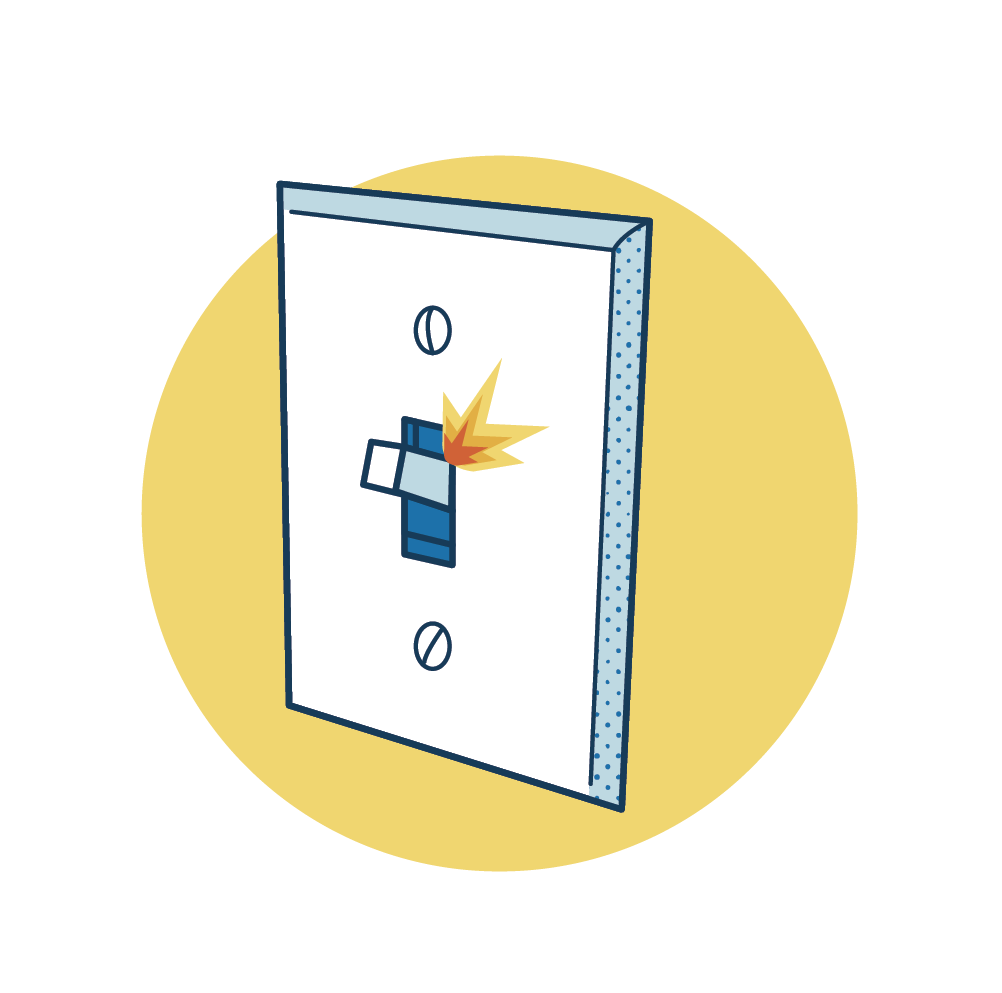
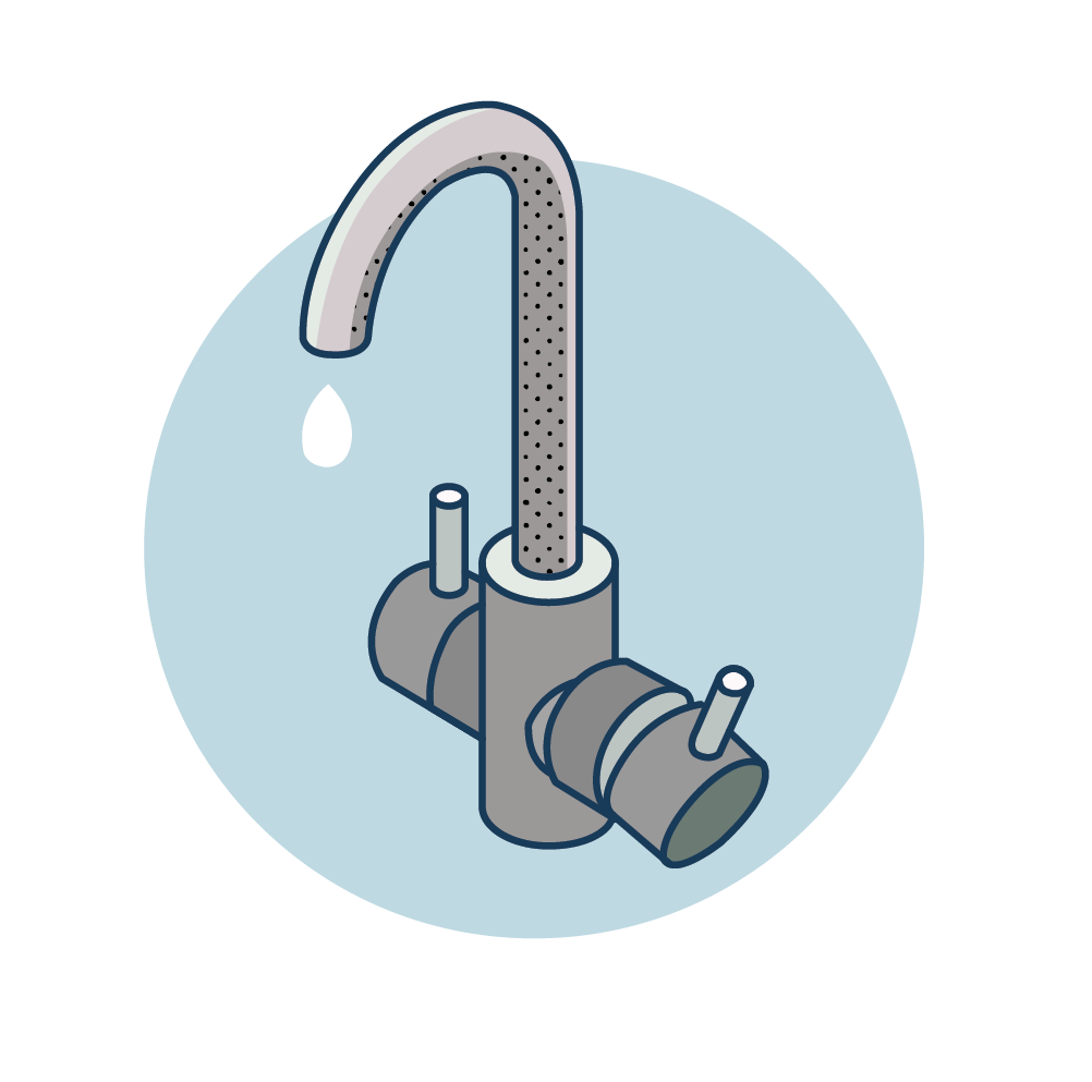
Turn off gas, electricity and water
Stay tuned to your local television and radio stations for emergency information
Charge your cell phone and mobile devices. Have extra chargers
On The Road
Leave early. Take your time.
The SC Emergency Response Team has been working in partnership with the petroleum industry in an attempt to make extra fuel available at certain gas stations along major evacuation routes. Rest areas along I-26 will be enhanced with additional facilities in order to accommodate motorists efficiently. Department of Public Safety weigh stations will also be available as comfort stations. A GPS may misdirect you to closed roads. Stay on official evacuation routes.

During
Protect Yourself
- Stay tuned to local television and radio stations for emergency information. Be sure to keep a battery operated, solar-powered, or hand-crank-operated radio or television for use during power outages.
- Stay inside a well-constructed building away from the windows and the doors, even if they are covered. Go to an interior first-floor room, closet, or under the stairs.
- Be alert. Tornadoes are very often spawned during hurricanes. If the “eye” of the storm passes over your area, be aware that severe conditions will return with winds from the other direction in a very short time.
- Limit non-emergency calls. Be sure to keep calls brief to minimize any network congestion. Wait at least 10 seconds before redialing a call. For non-emergencies, try sending text messages.
- Once the storm passes, be patient. You will most likely not be able to return home right away.


Seeking Safety
Be prepared for evacuation with a clear plan. Consider staying with family, friends, or booking a hotel inland. If those options aren’t available, emergency shelters will be provided by the SC Department of Social Services and the American Red Cross, as directed by local officials. Keep in mind that these shelters may lack cots, blankets, and other amenities, and may not have food for specialty diets. If using a shelter, bring essentials from your disaster kit, such as sleeping bags, pillows, and cots. For those with medical equipment requiring electricity, or who need space for a hospital bed, the SC Department of Public Health (DPH) offers Medical Equipment Power Shelters (MEPS) with generator power and extra space. Staff in these shelters are trained to provide CPR for medical emergencies while calling 911, but they do not provide any other medical care and may not be licensed health care workers. For this reason, a caregiver is generally required to come with the person seeking shelter. Bring medications, medical supplies, special foods, and comfort items. Access these shelters by calling 833-351-9990, where transport arrangements can be made if needed.
Returning Home
RETURN HOME ONLY AFTER LOCAL AUTHORITIES ADVISE IT IS SAFE TO DO SO. If you have evacuated, some areas may be inaccessible even after the official evacuation order is rescinded. Keep tuned to your local radio and TV stations and monitor social media for recovery information.
Avoid downed and sagging power lines
Report them immediately to the power company, police, or fire department.

Be alert for driving restrictions
Avoid flooded roads and washed-out bridges and roadways. Follow directions provided by public safety officials.

Enter your home with caution
- Open windows and doors to ventilate and dry your home.
- Use the telephone only for emergency calls.
- Check refrigerated foods for spoilage.
- Beware of snakes, insects, and other animals driven to higher ground by floodwater.
- Do not use candles or open flames indoors.
- Use a flashlight to inspect for damage.

Take pictures
Photos of the damage will help in filing insurance claims. Contact your insurance claims agent as soon as possible.
Let a relative know you are home
Tell them how to get in touch with you, especially if phone service is out.

Check for gas leaks
If you smell gas or hear a blowing or hissing noise, open a window and quickly leave the building. Turn off the gas at the outside main valve if you can. From a safe place, call to report a gas leak to your utility provider. If you turn off the gas for any reason, it must be turned back on by a professional.
Look for electrical system damage
If you see sparks, broken or frayed wires, or if you smell something burning, turn off the electricity at the main fuse box or circuit breaker. If you have to step in water to get to the fuse box or circuit breaker, call an electrician first for advice.
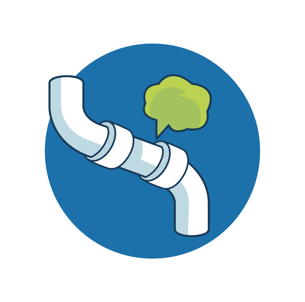
Check for sewage and water line damage
If you suspect sewage lines are damaged, avoid using the toilets and call a plumber. If water pipes are damaged, contact the water company and avoid water from the tap.
Monitor radio, TV, and social media
Learn how to apply for possible assistance and how to receive further official information. Local officials will provide information about how you can properly dispose of storm debris and damaged property.